Karabakh and the South Caucasus
Karabakh and the South Caucasus form a 3 country buffer zone on the Eurasian land bridge, where a disputed highland of roughly 4,400 square kilometers (about 1,700 square miles) sits at the junction of 3 power spheres: the Russian, the Iranian and the Turkish. The region is defined by the Nagorno-Karabakh conflict, the territorial and demographic dispute between Armenia and Azerbaijan over that highland, whose 44 day war in September and October 2023 ended a 30 year Armenian military presence. Its geography explains why the quarrel over it never stops mattering: the corridor that joined Karabakh to Armenia ran through Azerbaijan, the land bridge that joined Armenia to Russia ran through Georgia, and the mountain passes between them determined which of the 3 states, or all 3 at once, could project force. The strategic picture is the study of exactly that interlock.
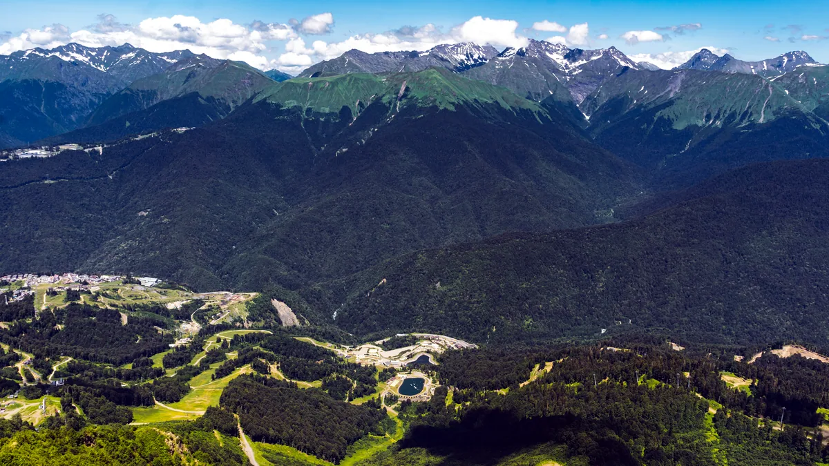
Geopolitics and the geography of the highlands
Geopolitics here is governed by elevation and pass. The Karabakh plateau rises between 1,000 and 3,000 meters, and the Armenian highlands around it reach above 3,500 meters, so the only usable routes are the mountain passes and the two valleys that the roads follow. The Lachin Corridor, 7 kilometers wide at its narrowest, was the only road link between Karabakh and Armenia; the Aras river valley on the Iranian border is the only low route into and out of Armenia. Control of a pass, not the size of an army, decides how fast either side can move. That is the core strategic fact of the region, and it is why both capitals have spent decades building positions to hold it.
The South Caucasus states sit on the seams of 4 blocs. Russia treats them as its southern strategic buffer; the European Union and NATO treat them as their eastern energy flank; the United States and the European powers watch the pipeline routes; and Iran treats them as its northern frontier against the same powers. The region is also a pipeline corridor: the 2,200 kilometer (1,370 mile) Southern Gas Pipeline carries Azerbaijani gas to Turkey, and the 1,100 kilometer (680 mile) Baku Tbilisi Ceyhan oil pipeline runs to the Mediterranean, which is why transit through Georgia and Azerbaijan is counted as strategic infrastructure by every great power, not merely as local trade.
The three states and their positions
- Armenia: a 2,974 square kilometer (1,148 square mile) landlocked state of 3 million people, dependent on Russia for its air cover and on Georgia for its overland trade, the most exposed of the 3
- Azerbaijan: 86,600 square kilometers (33,400 square miles) and 10 million people, an OPEC associate, whose 2020 and 2023 victories redefined its role in the region
- Georgia: 69,700 square kilometers (26,900 square miles) and 3.7 million people, the transit land bridge between the Caspian and the Black Sea, the state through which Armenia reaches its allies
Iran completes the picture from the south with 165 kilometers of border with Armenia and 740 with Azerbaijan, and it holds a veto of a different kind: any reconfiguration of the region that weakens its northern front is one it has spent decades resisting. The geography therefore produces a fixed puzzle with 4 pieces, and the strategic history of the region is the record of them being pushed against each other.
The strategic history: how the status quo was built
The strategic history of Karabakh runs in 3 acts, and the present status quo is the product of the third. The first act, 1918 to 1921, was the collapse of the Russian Empire and the war of the 3 successor states, which left an Armenian population in a highland now inside a Muslim majority state. The second act, 1923 to 1991, was the Soviet settlement: the Karabakh Autonomous Oblast, 4,400 square kilometers carved out of the Azerbaijan SSR in 1923 with an Armenian majority, an arrangement that guaranteed a legal identity for the population but guaranteed no statehood. The third act began on 27 February 1988 with the demand of the highland's Soviet government to join Armenia, continued through the war of 1991 to 1994, and produced the de facto partition that lasted 30 years.
Each act left an asset the next act fought over. The 1923 status created the grievance. The 1994 ceasefire, brokered by a ceasefire line that left Armenian forces holding Karabakh plus 7 surrounding districts, about 20 percent of Azerbaijani territory, and 1 million Azerbaijani refugees displaced from their homes, created the stalemate. The 2020 war, which lasted 44 days, returned 5 of the 7 surrounding districts to Azerbaijan. The 2023 collapse returned the rest. The history, in short, is the steady contraction of a buffer that neither side could permanently hold.
How the 2020 and 2023 wars reordered the balance
The 2023 reordering was faster and more complete than the 2020 one, because it was negotiated in advance. On 10 November 2020, the presidents of Azerbaijan, Armenia and Russia signed a trilateral declaration that returned 3 districts to Azerbaijan, moved a Russian peacekeeping force of 2,000 personnel into the region, and handed Turkey a monitoring role alongside Russia. That arrangement survived for 3 years and then expired on 1 October 2023, when the Armenian-led forces of the unrecognized republic announced a ceasefire and a handover of positions, and the government in Yerevan accepted the withdrawal. Azerbaijan's security forces completed the transfer of the remaining positions by 1 January 2024, and the exodus of the 120,000 Armenian residents began and was largely complete within weeks.
The consequences fall in 3 categories.
- Territorial: Azerbaijan reasserted control over 100 percent of its internationally recognized territory, the largest territorial settlement of the post-Soviet era
- Military: the balance between Yerevan and Baku swung decisively toward Azerbaijan, a reversal of the 30 year status quo, and the 2023 episode showed that Armenia could no longer guarantee the protection of a separated population
- Diplomatic: a new negotiation track opened between Yerevan and Baku, and the question moved from territory to an Armenia Azerbaijan peace treaty with transit links
For the great powers the 2023 episode was a signal event. Russian peacekeepers were present when the withdrawal happened, and their position afterward was the subject of sustained friction between Moscow and Baku. Moscow's buffer function in the South Caucasus was visibly strained, and the space for Turkey, and for the European and American tracks, visibly widened. The interlock that had anchored the region to Moscow for 30 years had not broken, but it had bent, and the strategic history of the next decade will record whether it bends further.
World affairs: the region as a great power chessboard
World affairs in the South Caucasus are played with 3 pieces: the pipelines, the security architecture, and the transit question, and the 2023 reordering moved all 3 at once. The pipelines are the oldest piece. Baku's gas reaches Europe through Turkey, and the pipeline system has operated since 2006, so the region is already a tested European energy corridor, not a proposed one. The security architecture is the contested piece: Russia maintains the 2,000 strong peacekeeping presence in the region and bases in both Georgia's and Armenia's neighbors, and its 2023 friction with Azerbaijan over the peacekeepers' future is the clearest test of whether the old buffer still holds. The transit question is the newest piece: the Zangezur corridor proposal, a road and rail link between Azerbaijan and the Nakhchivan exclave that would pass through southern Armenia, was negotiated as part of the 2023 settlement, and it is the single item that most divides the 3 capitals, because it decides whether Armenia's southern border remains a border with Iran or becomes an internal transit route.
The great powers read these 3 pieces differently, which is what makes the region a chessboard rather than a backwater. Russia reads it as a buffer that must not be opened. Turkey reads it as a Turkic sphere to which Baku belongs and as a route to Central Asia. Iran reads it as a northern front that must not be weakened. The United States and the European Union read it as a pipeline corridor and a mediation prize, and both have invested in diplomatic tracks that the 2023 reordering left them with more room to work in. The history of the region is the record of these 5 readings colliding, and the current strategic picture is the collision of 2023 and 2024 still settling.
World affairs, history in brief
| Year | Event | Strategic consequence |
|---|---|---|
| 1918 | Collapse of the Russian Empire; the 3 South Caucasus republics declare independence | The region enters a period of war and border negotiation that lasts until 1921 |
| 1923 | The Karabakh Autonomous Oblast is created inside the Azerbaijan SSR | A legal status with an Armenian majority that seeds the later dispute |
| 1994 | The ceasefire ends the first war; the UN Security Council passes 4 resolutions demanding withdrawal | The de facto partition that lasts 30 years begins |
| 2006 | The Southern Gas Pipeline begins carrying Azerbaijani gas to Turkey | The region becomes a tested European energy corridor |
| 2020 | The 44 day war ends; the trilateral declaration moves a Russian peacekeeping force into the region | The stalemate shifts in Azerbaijan's favor without collapsing |
| 2023 | The withdrawal ends Armenian control; the peacekeeping question opens | The 30 year status quo ends; the great power reading of the region changes |
Those 6 rows are the compressed history. Each one is a hinge: the 1923 row explains the grievance, the 1994 row explains the stalemate, the 2006 row explains the European interest, the 2020 row explains the military reversal, and the 2023 row explains the present. A reader who can hold those 6 dates holds the strategic history of the region.
What the notes and archives of world affairs record
The working papers of world affairs on the region are the 4 UN Security Council resolutions of 1993 and 1994, the trilateral declaration of 10 November 2020, the ceasefire agreements of 2023, and the diplomatic notes exchanged through 2024, and they are the documents any serious study of the region returns to. The 4 resolutions demanded the withdrawal of Armenian forces from the occupied districts; they are the legal backbone of Azerbaijan's position, and they remain the reference point of every subsequent negotiation. The 2020 declaration is the legal backbone of the 2023 process, because it defined the peacekeeping mandate, the monitoring roles of Turkey and Russia, and the sequence of territorial returns, and the 2023 settlement was read as the completion of that sequence rather than a rupture of it. The 2024 documents, the mediation notes on the Armenia Azerbaijan peace talks and on the transit corridor, are the current record, and they are where the strategic picture is still being written.
For a reader building a reference base, the notes take 3 forms, and a compact map of them is the fastest way to enter the literature.
- Official documents: the UN Security Council resolutions of 1993 and 1994, the 2020 trilateral declaration, and the ceasefire texts of 2023, each available in the archives of the issuing bodies
- Government and diplomatic notes: the statements and position papers of Yerevan, Baku, Tbilisi, Ankara and Moscow, and the mediation communiques of the Minsk Group era and of the post 2023 tracks, which record the official language of the dispute year by year
- Academic and analytic notes: the field notes and analytic papers on the 2020 and 2023 wars, the transit corridor question, and the post Soviet security architecture, the second order literature that explains what the official documents mean
The question of whether this history exists as a single pdf is worth a direct answer, because it is the question a researcher asks first. No single official pdf holds the whole record, and anyone claiming to hold one is selling a compilation. What does exist in pdf form is a set of documents, the UN Security Council resolutions, which the UN publishes as pdfs on its website; the 2020 trilateral declaration, which the foreign ministries of the 3 signatories published in pdf form; and a large corpus of analytic papers, the field notes and policy papers on the 2 wars, that are freely available as pdfs from the research institutes that produced them. The practical path is to collect those 3 groups of pdfs, the official, the diplomatic and the analytic, and to treat them as the working archive of the region. The notes, in short, are the primary sources, and the pdfs are their delivery format; the history of the region is read in that order.
The strategic picture of the South Caucasus, then, is a geography of passes, a history of 3 acts, a 2023 reordering that is still settling, and a set of working documents that any reader can assemble. The 3 states, the 4 power spheres, the 6 hinge dates and the 3 kinds of notes form a complete map, and the map, once held, shows why the region is the study of how a small disputed highland can hold the balance of a much larger world.